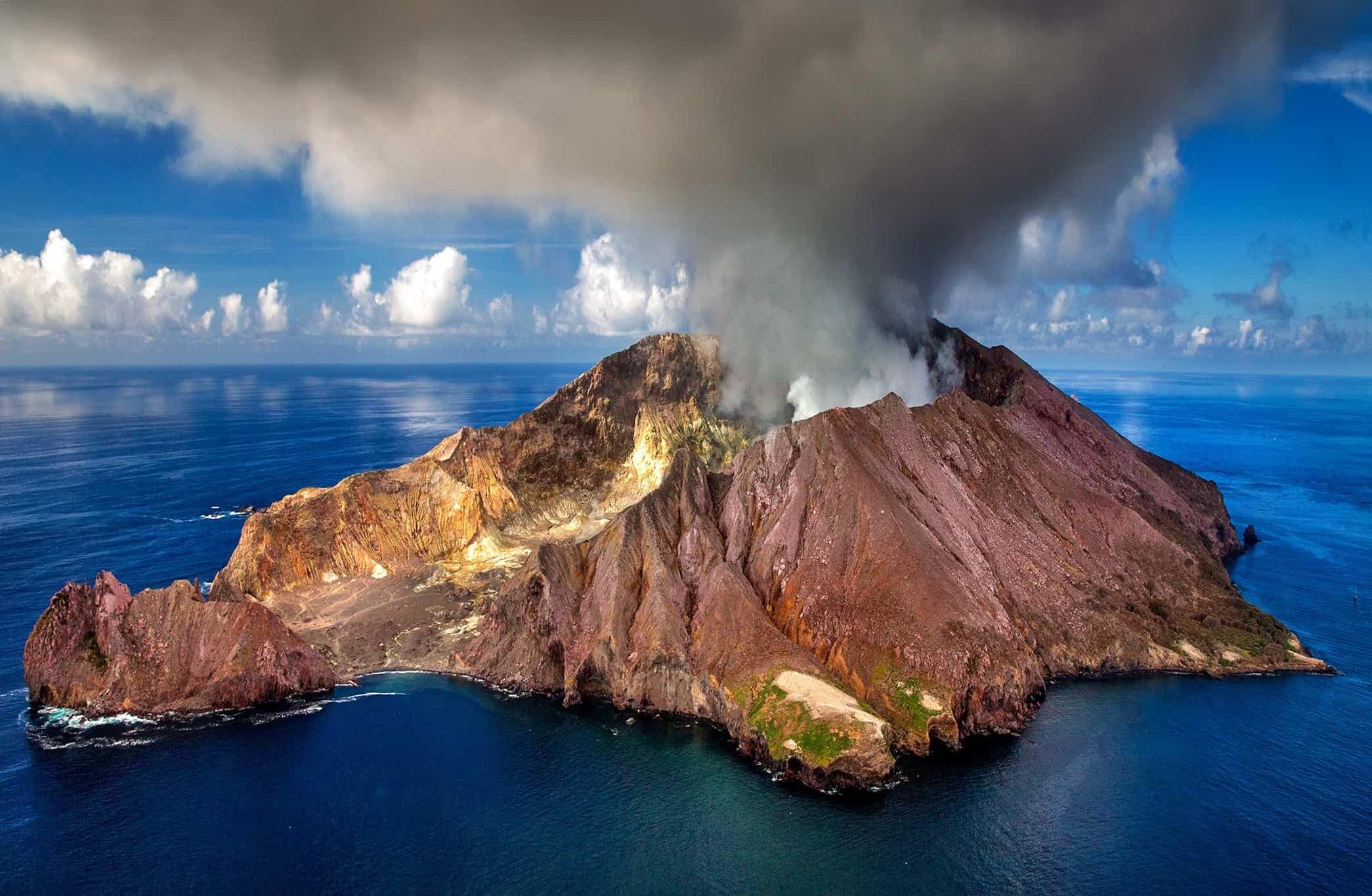
Recent and currently Active, Potential Eruptions around the Ring of Fire and around the World. Information about Prehistoric Super Volcanoes that have played a significant role in our planets history and shaping our environment.
Latest News on Active Volcanoes Around the World.
- Worldwide earthquakes above magnitude 3 during the past 24 hours on 14 Dec 2025Summary: 3 quakes 5.0+, 34 quakes 4.0+, 149 quakes 3.0+, 402 quakes 2.0+ (588 total)This report is being updated every hour.Magnitude 5+: 3 earthquakesMagnitude 4+: 34 earthquakesMagnitude 3+: 149 earthquakesMagnitude 2+: 402 earthquakesNo quakes of magnitude 6 or higher10 largest earthquakes in […]
- Volcanic Ash Advisory Center Washington (VAAC) issued the following report:FVXX25 at 15:26 UTC, 14/12/25 from KNESVA ADVISORYDTG: 20251214/1524ZVAAC: WASHINGTONVOLCANO: RUIZ 351020PSN: N0453 W07519AREA: COLOMBIASOURCE ELEV: 17319 FT AMSLADVISORY NR: 2025/579INFO SOURCE: GOES-19. VONA. WEBCAM. NWP MODELS. ERUPTION DETAILS: VONA RPRT RCVDEST VA DTG: 14/1450ZEST VA CLD: SFC/FL190 N0459 W07525 – N0454 W07519- N0452 W07519 – […]
- Volcanic Ash Advisory Center Darwin (VAAC) issued the following report:FVAU02 at 13:12 UTC, 14/12/25 from ADRMVA ADVISORYDTG: 20251214/1320ZVAAC: DARWINVOLCANO: SEMERU 263300PSN: S0806 E11255AREA: INDONESIASOURCE ELEV: 3657M AMSLADVISORY NR: 2025/1425INFO SOURCE: CVGHMERUPTION DETAILS: ERUPTION LAST REPORTED AT 14/1218ZEST VA DTG: 14/1250ZEST VA CLD: SFC/FL140 S0808 E11254 – S0804 E11253 – S0754 E11308 – S0800 E11314 – […]
- Satellite image of Marapi volcano on 14 Dec 2025Volcanic Ash Advisory Center Darwin (VAAC) issued the following report:FVAU04 at 11:05 UTC, 14/12/25 from ADRMVA ADVISORYDTG: 20251214/1104ZVAAC: DARWINVOLCANO: MARAPI 261140PSN: S0023 E10028AREA: INDONESIASOURCE ELEV: 2885M AMSLADVISORY NR: 2025/178INFO SOURCE: CVGHMERUPTION DETAILS: GROUND REPORT OF ERUPTION TO FL140 AT 14/0936Z MOV NEST VA DTG: 14/1040ZEST VA CLD: […]
- Volcanic Ash Advisory Center Washington (VAAC) issued the following report:FVXX21 at 10:47 UTC, 14/12/25 from KNESVA ADVISORYDTG: 20251214/1045ZVAAC: WASHINGTONVOLCANO: POPOCATEPETL 341090PSN: N1901 W09837AREA: MEXICOSOURCE ELEV: 17693 FT AMSLADVISORY NR: 2025/512INFO SOURCE: GOES-19. NWP MODELS. ERUPTION DETAILS: OCNL VA EMSEST VA DTG: 14/1031ZEST VA CLD: SFC/FL200 N1902 W09837 – N1847 W09817- N1841 W09825 – N1900 W09837 […]
- Explosive activity continues. Volcanic Ash Advisory Center (VAAC) Washington warned about a volcanic ash plume that rose up to estimated 18000 ft (5500 m) altitude or flight level 180 .The full report is as follows:FVXX24 at 09:44 UTC, 14/12/25 from KNESVA ADVISORYDTG: 20251214/0941ZVAAC: WASHINGTONVOLCANO: PURACE 351060PSN: N0219 W07624AREA: COLOMBIASOURCE ELEV: 15256 FT AMSLADVISORY NR: 2025/085INFO […]
Click this link to see pics of current or recent volcanoes that have erupted around the world.
https://www.volcanodiscovery.com/photos/volcanoes.html
Major Volcanoes along the Ring of Fire.

The Ring of Fire is a horseshoe-shaped zone of intense seismic and volcanic activity encircling the Pacific Ocean. It spans approximately 40,000 kilometers (25,000 miles) and includes about 75% of Earth’s active volcanoes. This region is a direct result of plate tectonics, where tectonic plates collide, subduct, or slide past each other. Subduction zones, where one plate is forced beneath another, are particularly common here, leading to the formation of volcanic arcs and deep ocean trenches. A common and well know volcanic arc is
The Ring of Fire, also known as the Circum-Pacific Belt, is a seismically active region encircling the Pacific Ocean. It spans approximately 40,000 kilometers (24,900 miles) and marks the boundaries of several major tectonic plates, including the Pacific, Juan de Fuca, Cocos, Indian-Australian, Nazca, North American, and Philippine Plates.
This region is home to 75% of Earth’s volcanoes (over 450) and accounts for 90% of Earth’s earthquakes, including the most violent and dramatic seismic events. The volcanic activity primarily arises from subduction zones: areas where one tectonic plate is forced beneath another, generating magma close to Earth’s surface. Exceptions include transform boundaries, such as the one between the Pacific and North American Plates, where plates slide past each other, producing significant earthquakes.

https://commons.wikimedia.org/wiki/File:Cascade_Volcanic_Arc.jpg
It is well known in the UNITED STATES and has caused many recent minor quakes and 1 volcanic eruption in our time. This event was known as Mount St. Helens in 1981, located in the State of WASHINGTON.

Lyn Topinka, Public domain, via Wikimedia Commons
Here’s a list of significant earthquakes and fault lines along the Ring of Fire from 1880 to the present:
- 1883 Krakatoa Eruption and Earthquakes (Indonesia): Accompanied by seismic activity, this event caused massive tsunamis.
- 1906 San Francisco Earthquake (USA): Magnitude 7.9, caused widespread destruction along the San Andreas Fault.
- 1960 Valdivia Earthquake (Chile): The strongest earthquake ever recorded, with a magnitude of 9.5.
- 1964 Alaska Earthquake (USA): Magnitude 9.2, caused tsunamis and significant damage.
- 1995 Kobe Earthquake (Japan): Magnitude 6.9, devastating the city of Kobe.
- 2004 Indian Ocean Earthquake (Indonesia): Magnitude 9.1–9.3, triggered a catastrophic tsunami.
- 2011 Tōhoku Earthquake (Japan): Magnitude 9.0, caused a tsunami and the Fukushima nuclear disaster.
The Fukushima nuclear disaster released significant amounts of radioactive material into the Pacific Ocean, raising concerns about its impact on marine life. Studies suggest that radioactive isotopes like cesium-137 and iodine-131 entered the marine ecosystem, affecting organisms at various levels of the food chain.
While acute effects on marine populations were not widely observed, certain species, particularly benthic fish living near the seafloor, were exposed to higher levels of contamination due to sediment accumulation. The long-term consequences remain a subject of ongoing research, with scientists monitoring “hotspots” near Fukushima for potential impacts on biodiversity and ecosystem health.
https://www.whoi.edu/oceanus/feature/how-is-fukushimas-fallout-affecting-marine-life/
https://www.sciencedaily.com/releases/2016/10/161018141309.htm
https://www.whoi.edu/oceanus/feature/fukushima-disaster-response/
The world’s largest volcanic eruption to happen in the past 100 years occurred on June 15, 1991, with the eruption of Mount Pinatubo in the Philippines. While incredibly powerful and impactful, It was not heard around the world as Krakatau was. However, it did release an enormous amount of volcanic ash and sulfur dioxide into the atmosphere, causing significant global cooling and vivid sunsets. The ash was monitored and seen traveling across the world. “The collaborative work of scientists from the U.S. Geological Survey (USGS), and the Philippine Institute of Volcanology and Seismology (PHIVOLCS) saved more than 5,000 lives and $250 million in property by forecasting Pinatubo’s 1991 climactic eruption in time to evacuate local residents and the U.S. Clark Air Force Base that happened to be situated only 9 miles from the volcano. U.S. and Filipino scientists worked with U.S. military commanders and Filipino public officials to put evacuation plans in place and carry them out 48 hours before the catastrophic eruption. As in 1991 at Pinatubo, today the USGS is supported by The US Agency for International Development’s (USAID) Office of U.S. Foreign Disaster Assistance to provide scientific assistance to countries around the world though VDAP, the Volcano Disaster Assistance Program. The program and its partners respond to volcanic unrest, build monitoring infrastructure, assess hazards and vulnerability, and improve understanding of eruptive processes and forecasting to prevent natural hazards, such as volcanic eruptions, from becoming human tragedies.” USGS link below
https://www.usgs.gov/news/featured-story/remembering-mount-pinatubo-25-years-ago-mitigating-a-crisis
https://www.usgs.gov/media/images/toms-satellite-image-showing-how-ash-had-circled-globe-30-jun-91

The eruption often associated with sound traveling globally is the 1883 Krakatoa eruption in Indonesia. Krakatoa produced one of the loudest sounds ever recorded, heard up to 3,000 miles away. Its shockwave reportedly circled the globe multiple times!
Both events profoundly shaped Earth’s atmosphere and ecosystems, but Krakatoa’s eruption truly reverberated across the planet—literally.
The 1883 eruption of Krakatoa, located in the Sunda Strait between Java and Sumatra in Indonesia, is one of the most catastrophic volcanic events in recorded history. Here’s a closer look:
https://www.bbc.com/news/world-asia-46663158
Key Details:
The 1883 eruption of Krakatoa was indeed one of the most catastrophic volcanic events in history, with far-reaching consequences.
-Explosivity: The eruption had a Volcanic Explosivity Index (VEI)of 6, making it one of the most powerful eruptions ever recorded.
-Destruction: Over 70% of the island of Krakatoa and its surrounding archipelago were destroyed as the volcano collapsed into a caldera.
-Sound: The explosion was so lout that it was heard up to 3,000 miles (4,800 Kilometers) away, making it the loudest sound in recorded history.
-Tsunamis: The eruption triggered massive tsunamis, some reaching heights of 120FT (37 meters), which devastated coastal areas and caused most of the estimated 36,000-120,000 deaths.
-Global Impact: The eruption released massive amounts of ash and sulfur dioxide into the atmosphere, causing a volcanic winter. Global temperatures dropped by an average of 1.2°C (2.2°F) over the following years.
-Atmospheric Effects: The ash and gases in the atmosphere created vivid sunsets and a blue moon phenomenon worldwide for months.
This event not only reshaped the geography of the region but also had profound effects on the global climate and inspired advancements in volcanology.
https://www.historyhit.com/facts-about-the-eruption-of-krakatoa/
Legacy
The eruption was one of the first global natural disasters to be widely reported, thanks to the advent of telegraphy and modern communication. It also inspired scientific studies on volcanic activity and atmospheric effects.
In the years following the eruption, a new volcanic island, Anak Krakatau (“Child of Krakatoa”), emerged from the caldera. Anak Krakatau remains active, with notable eruptions in recent years, including one in 2018 that caused a deadly tsunami.
The success at Pinatubo demonstrates the life-saving potential of combining science, technology, and collaboration. Before modern monitoring systems, societies often relied on oral traditions, myths, and visible signs like unusual animal behavior to predict disasters. While these methods were often imprecise, they highlight humanity’s long-standing determination to understand and mitigate nature’s fury.
A focus on early warnings could greatly contribute to saving lives. Advancements in seismology, remote sensing, and data analysis have already improved predictive capabilities, but there’s always room for innovation. Understanding patterns from past events, like Pinatubo, provides critical insights for refining these tools and processes. If we are able to read the warning signs and take heed, it just might save more lives.
You must be logged in to post a comment.